

- About Upazilla
- Upazilla Parishad
- Upazilla Administration
- Municipality
-
Government Offices
Human Resources Development
-
Upazila Social Services Office
-
Upazila Youth Development Office
-
Upazila Cooperative Office
-
Upazila Women affairs office
-
Upazila Rural Development Office
-
Upazila Palli Sanchoy Bank
-
Upazila Polli Jibikayon Project
-
Upazila Palli Daridro Bimocon Foundation Office
-
সামাজিক বনায়ন ও নার্সারী প্রশিক্ষণ কেন্দ্র
-
Upazila Social Services Office
- Different Institutions
- e-Services
- Gallery
-
TCB List
Municipality and Union Based TCB List
মেনু নির্বাচন করুন
-
About Upazilla
Introduce to Upazila
History & Tradition
Geography & Economics
অন্যান্য
- Upazilla Parishad
-
Upazilla Administration
Upazilla Nirbahi Officer
About Organogram
Schedule & Meeting
Service & Others
- Municipality
-
Government Offices
Security & Discipline Affairs
Education & Culture
Agriculture, Fish, Animal & Food
Health & Environment
Engineering and ICT
Human Resources Development
- Upazila Social Services Office
- Upazila Youth Development Office
- Upazila Cooperative Office
- Upazila Women affairs office
- Upazila Rural Development Office
- Upazila Palli Sanchoy Bank
- Upazila Polli Jibikayon Project
- Upazila Palli Daridro Bimocon Foundation Office
- সামাজিক বনায়ন ও নার্সারী প্রশিক্ষণ কেন্দ্র
Land & Revenue
-
Different Institutions
Educational Institutions
Non-Govt. Organizations
Religious Institutions
- e-Services
-
Gallery
Photogallery
Video Gallery
-
TCB List
Municipality and Union Based TCB List
Main Comtent Skiped
Background of the Upazila:
Background of the upazila
Origin of the upazila: Before 1971, Lalmonirhat was a thana in Adin of Kurigram subdivision under Rangpur district. The present Lalmonirhat district was declared a subdivision in 1981.
Area: Lalnirhat Sadar Upazila Area: 259.54 sq km Population: 3,33,17.
Location: Cooch Behar district of India in the north, Kaunia upazila of Rangpur district in the south, Fulbari upazila of Kurigram district in the east, Aditmari upazila in the west.
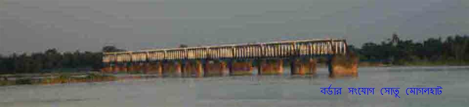
Historic places, slaughterhouses: Mughalhat is considered as a historical place. This is because during the Mughal period, temporary shelters were set up here for the purpose of attacking Cooch Behar.
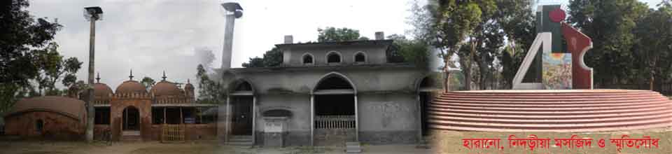
Slaughterhouse: There is a mass grave site in Lalmonirhat Wireless Colony. Which is currently officially preserved.
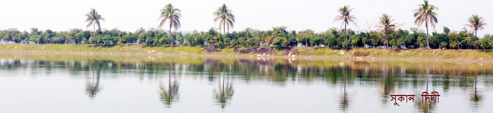
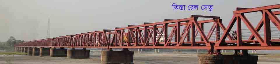
Upazila Specialty: Located in the foothills of the Himalayas. Teesta is situated in the middle of Dharla river basin.


Site was last updated:
2025-07-03 13:09:09
Planning and Implementation: Cabinet Division, A2I, BCC, DoICT and BASIS
Technical Assistance:
![]()
Developed By:
